


")


 talk about true reconciliation")


By David Himbara
Attending the African Aviation Conference on February 22, 2017, President Paul Kagame is watching here “Planes Live.”
This is an online tool that provides instant information on any flight anywhere in the world. Planes Live tracks every flight in the air, landing, or taking off anywhere, and anytime around the globe.
So why is Kagame looking so depressed? The answer might be in a closer look at what Planes Live reveals about Rwanda. Here is a snapshot of Eastern and Southern Africa.
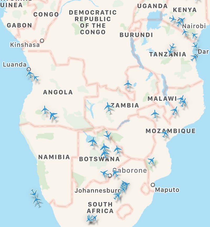
There is no plane anywhere near Kagame’s Singapore of Africa. Except for Nairobi, Kenya, and Dar Es Salaam, Tanzania, there are no planes in sight in East and Central Africa. Most planes heading towards, or leaving South Africa on the way to Europe or Asia.
Unknown to Kagame and his statistical manipulators, there are now many tools to measure development in very interesting ways. These tools help us to catch lies. Planes Live, indicates, for example, heavy or light commercial traffic.
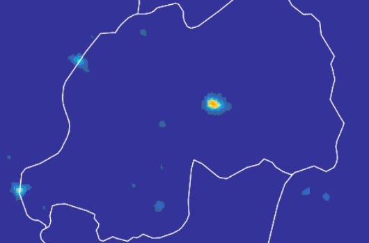
But by far, nightlight data has become an extremely useful to measure economic development. Nightlight “refers to light resulting from human activity visible from outer space at night.”
Nightlight is accurate since it shows human use of energy that is emitted or reflected into the sky. In Kagame’s Rwanda, only Kigali appears from the skies at night – the rest of the country is in the dark.
Mr. Kagame, there is no shortcut to social and economic development. Its about dedication to building natural capital, social capital, human capital, infrastructural capital and financial capital. You cannot wish any of these to happen by miracle – no Sir!


")


